
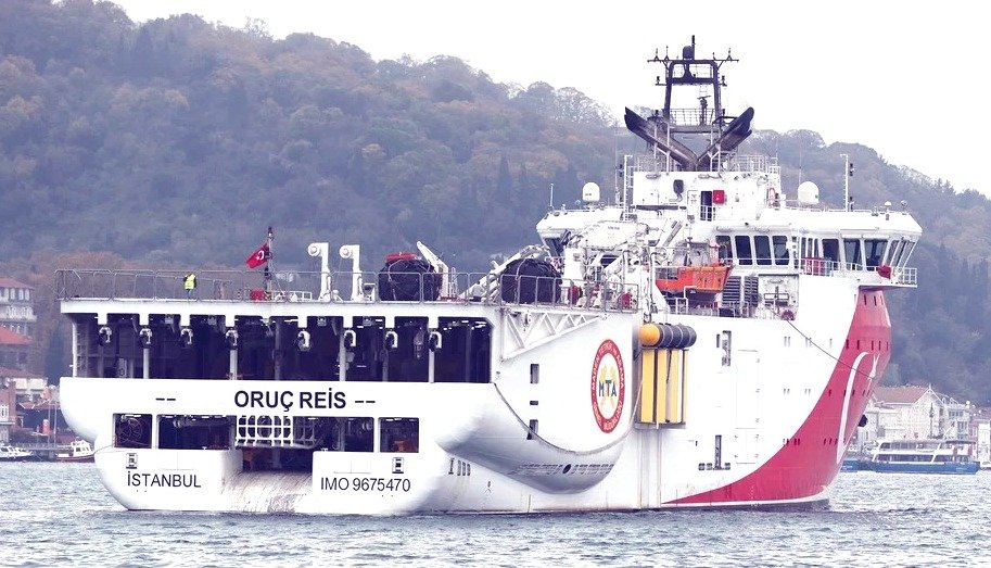
Nicosia; November 2026: Cyprus has formally informed the United Nations that Turkish research vessels are carrying out seabed surveys in its waters for a planned natural gas pipeline to the occupied north.
The letter, from Cyprus UN permanent representative ambassador Maria Michael to the UN Secretary General, describes the activity as “a further step” towards building the pipeline and a breach of the island’s sovereignty. Cyprus said that Turkey issued an unauthorised Navtex shipping warning on September 30th for “scientific research and undersea operations”. The vessels named are the Turkish-flagged Oruc Reis, Denar Pathfinder, Denar Echo and Kirici.
According to the letter, the operations took place in Cyprus territorial sea, exclusive economic zone and continental shelf “without the permission or consent of the Republic”. Cyprus has asserted that this exercise breaches international law, as set out in the UN Convention on the Law of the Sea (UNCLOS), and that carrying out surveys to install an undersea pipeline in territorial waters without consent is a violation of sovereignty.
The letter has also warned that such infrastructure would be “a further attempt to create an irreversible faits accomplis” affecting Cypriot territory and maritime zones, and would “deepen the integration of the occupied areas into Turkey”.
Today’s letter follows an earlier letter in August this year (2026), which dealt with a memorandum of understanding signed in July between Turkey and the north, which the republic denounces as illegal.
“Any steps towards the implementation of the alleged ‘memorandum of understanding’, including any preparatory or related activities, are illegal and must cease immediately”, it said.
Greek and Cypriot authorities had jointly issued the Navtex maritime notices on Friday (06th November 2026) for seabed surveys by the French research vessel Abeille Marengo along the planned route of the Great Sea Interconnector (GSI), the electricity link between Crete and Cyprus.
Turkey responded with a counter-Navtex, claiming part of the area lies within its continental shelf and that it had “not consented” to the work. The Turkish foreign ministry said the procedure regarding the approval which is required had not been completed, and a Turkish drone has been flying surveillance over the cable route south of Karpathos.
Greek diplomatic sources replied that the vessel’s work “will proceed based on the company’s operational planning” and that the international law of the sea “is clear and does not allow for different interpretations”.
It was on Friday, 06th November 2026, Greece’s Independent Power Transmission Operator (ADMIE) and Great Sea Interconnector SA have issued a maritime notice HA15-1411/26, that the Greek and Cypriot authorities have issued the necessary Navtex maritime notices for seabed surveys along the planned route of the Crete-Cyprus electricity interconnection. The surveys will be carried out by the research vessel Abeille Marengo in maritime areas along the proposed route.
According to the announcement, the surveys form part of ongoing technical work on the Great Sea Interconnector (GSI) and will provide additional data required for the project’s detailed technical design.
In its notice, numbered 1105/26, Turkey has claimed that part of the maritime area covered by the Greek Navtex falls within Turkey’s continental shelf, the boundaries of which were communicated to the United Nations on March 18, 2020. Turkish authorities have also claimed that they have not given their consent for the research activities described in the Greek notice, which they describe as “unauthorised”.
The development comes amid continuing uncertainty over the implementation of the GSI project, which has faced delays linked to maritime disputes in the eastern Mediterranean.
Team Maverick.