An Integrated Digital Public Infrastructure for Land Administration
Mumbai, Sept 2026 : The MahaBhumi Stack system will make information related to ownership of all land parcels in the state available at the click of a button, thereby giving a boost to investment and economic development in Maharashtra, Chief Minister Devendra Fadnavis said.
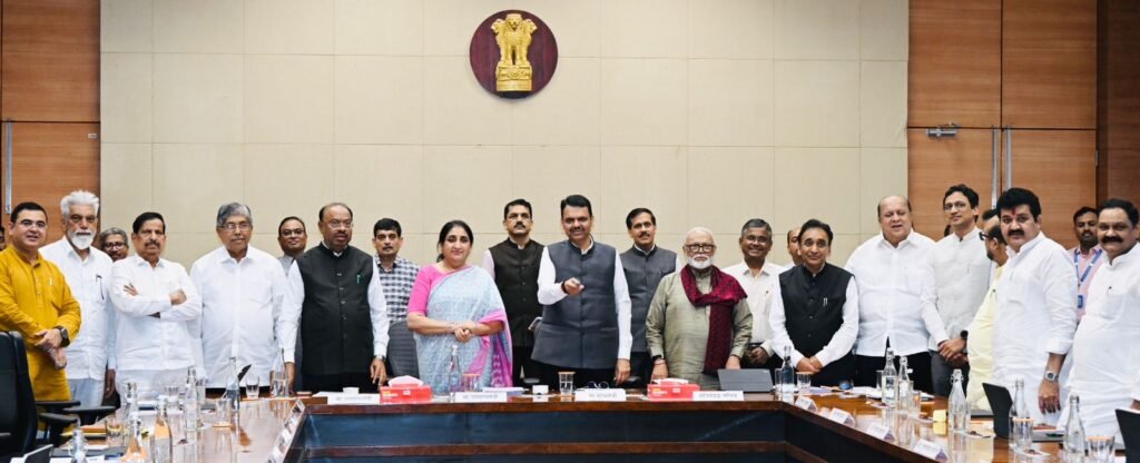
The MahaBhumi Stack system, developed by the Revenue and Forest Department of the Maharashtra Government for land administration, was launched following the state Cabinet meeting. Chief Minister Fadnavis was speaking on the occasion. Additional Chief Secretary of the Revenue Department Vikas Kharage made a presentation on the system.
Citizens currently have to rely on various systems such as MahaBhulekh, MahaBhunakasha and IDRS for land purchase and sale transactions and for several requirements after a transaction. These scattered systems have now been integrated through MahaBhumi Stack, providing a single integrated digital gateway for 10 major categories of land-related services. Chief Minister Fadnavis said this marks a significant milestone in the state's revenue and land-related reforms.
The state government has adopted the policies of Ease of Living and Ease of Doing Business, and the MahaBhumi Stack system has been developed in line with these objectives. Chief Minister Fadnavis directed the Revenue Department to ensure the effective use of the system and make special efforts to ensure that citizens are able to take full advantage of the service.
MahaBhumi Stack: A Digital Repository of Land Records
- More than 3.5 crore Records of Rights (7/12 and 8-A extracts)
- More than 1.5 crore land maps and property cards
- More than 40 crore historically scanned mutation records and old land records
- Copies of Registration Department Document No. 2 and the updated status of cases before revenue courts
Key Feature of the System
By entering the survey/group number for rural areas or the CTS/city survey number for urban areas, users will be able to access all information related to a particular land parcel in an integrated format.
The system will provide:
- Details of the current users and Records of Rights (7/12 extract) of the land parcel
- Details of all previous mutations carried out on the land
- References to registered transactions related to the land parcel (Document No. 2)
- Land-survey information, village maps and measurement details
Benefits for Citizens
Transparency in Transactions and Prevention of Fraud
Before buying or selling any land parcel, citizens will be able to independently verify information on their mobile phones, including who the current users of the land are, whether there are any encumbrances and whether any court proceedings are pending. This will reduce dependence on intermediaries.
One Window, Multiple Services
Citizens will no longer need to visit different portals or government offices for services such as 7/12 extracts, 8-A extracts, maps, mutation status, measurement applications and document searches.
Savings in Time, Effort and Cost
All required land records will be accessible from home. These records can also be securely shared digitally for purposes such as obtaining bank loans or accessing various government schemes.
Common Facility for Rural and Urban Areas
Citizens in rural areas will be able to easily search property information using the group number, while residents of urban areas such as Pune and Mumbai will be able to access property details using the CTS number.
Benefits for Administration and Institutions
The Revenue Administration will be able to speed up verification and decision-making processes. Banks and financial institutions will be able to quickly verify the current user and transaction history of a land parcel before approving loans.
Greater clarity regarding land records will also make it easier for industries and investors to make investment decisions.
Future Development of the System
MahaBhumi Stack will be further developed towards GIS-based land visualisation, AI-based search facilities and integration with systems of Urban Local Bodies.
The system is expected to emerge as a powerful platform for inter-departmental digital governance, further strengthening transparency, efficiency and accessibility in land administration.