Land records to become more transparent; technology extended from tehsils to ULBs, ensuring crops are not damaged during surveys
Work begins with rovers in 350 tehsils, marking a major shift from chains and measuring tapes to centimetre-level accuracy
143 rovers accelerate mapping projects across 10 ULBs; training completed at Lekhpal training institutes
CM Yogi launched the Section 24 mega campaign from Saharanpur; digital technology will now speed up demarcation
Lucknow, September 2026 : The process of land measurement and demarcation in Uttar Pradesh is gaining new momentum with the use of advanced technology. The Yogi government is deploying Global Navigation Satellite System (GNSS) rover technology on a large scale to modernise the functioning of the Revenue Department.
Of the 504 GNSS rovers available in the state, 350 have been supplied to tehsils and work has already begun using the equipment. Another 143 rovers are being used for mapping projects across 10 Urban Local Bodies (ULBs). Two rovers have been deployed at the KTS (Consolidation Training Centre) in Hardoi, while all training programmes have been completed using nine rovers purchased for Lekhpal training institutes.
The move is shifting land measurement from traditional methods towards a faster, more accurate and digital system.
One Technology for Multiple Tasks, from Fields to Maps
Kanchan Verma, Commissioner and Secretary, Board of Revenue, said the deployment of GNSS rovers is not limited to tehsils. Following the deployment of 350 rovers at tehsil level, they are being used for field surveys.
In addition, 143 rovers have been deployed for mapping projects in 10 ULBs, while two have been provided to the KTS in Hardoi. Nine rovers purchased for Lekhpal training institutes have also been used for training, and all training programmes have been completed.
This demonstrates that along with introducing technology into revenue administration, the department is also focusing on equipping its personnel with the skills required to operate the new technology.
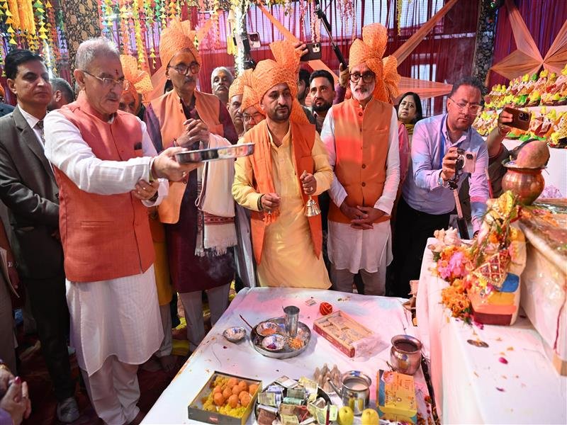
CM Yogi Laid Foundation of Campaign in Saharanpur
Verma said a special mega campaign under Section 24 was conducted from July 1 to August 15 for the speedy resolution of cases related to land boundaries and measurement.
Chief Minister Yogi Adityanath launched the campaign from Saharanpur on July 1. To ensure its effective and uniform implementation, the Revenue Department also issued a Standard Operating Procedure (SOP).
The availability of modern survey technology is now strengthening this system further by enhancing the technical capabilities involved in land-related work.
Multiple Benefits of GNSS Rover Technology
Centimetre-Level Accuracy
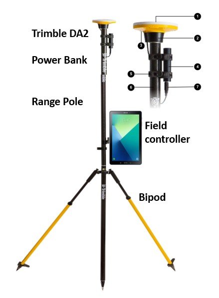
A GNSS rover is an advanced surveying device that determines the precise position of a point on the ground using signals received from various satellite systems. When connected to Uttar Pradesh’s network, it can provide accuracy of approximately 1 to 5 centimetres.
Surveyors record the digital coordinates of key points along a field or land boundary. Software is then used to calculate distances and areas and generate digital maps.
Shift from Chains and Tapes to Digital Measurement
Compared with traditional land measurement methods involving chains and measuring tapes, rover technology makes surveys more scientific and digital.
The digital coordinates collected in the field can be integrated with Geographic Information System (GIS) and land-record systems. This makes it easier to securely store the data, verify its quality and retrieve it whenever required.
Reduced Scope for Human Error
The key points of land boundaries are digitally recorded through rovers. This reduces human intervention in calculating distances and areas, thereby lowering the possibility of errors.
Large areas can be surveyed in less time and with comparatively fewer personnel. The technology is also helping save time and costs in large-scale land surveys and mapping projects.
Land Measurement Without Damaging Crops
There is always a possibility of crops being damaged during the measurement of agricultural land. The use of GNSS rovers reduces the need for repeated movement across fields and lengthy conventional surveying procedures.
By capturing the digital coordinates of essential boundary points, surveys can be conducted without causing damage to standing crops. This is also making the process more convenient for farmers.
Digital Records to Enhance Transparency
The digital data generated through rover technology is helping make land records and mapping systems more organised. It also facilitates quality checks of records and ensures better traceability of data.
The technology is being used for land parcel surveys, cadastral mapping, mapping projects and GIS-based mapping. Its wider adoption is expected to further modernise revenue administration in Uttar Pradesh while making land measurement and demarcation faster, more accurate and transparent.