
United Nation’s proposal to introduce Global Geospatial Information Day.
A proposal was submitted to the UN-GGIM Bureau by Fiji in May 2025, outlining the rationale for a United Nations General Assembly resolution to establish a Global Geospatial Information Day, which would be observed every four years on the first Wednesday in August of each leap year, beginning from 2028.
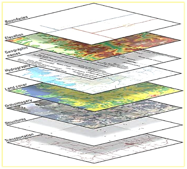
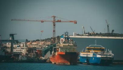
Geospatial information is data that is referenced to a location or place, such as geographic coordinates, an address, a building, or even a vehicle travelling along a road, ships at sea, aircraft in flight, and satellites in orbit. It describes the location of ‘where’ all things are, and provides the digital connection between people, their place, their activities, and their environment. Geospatial information reflects the digital version of our physical world, in which all human, economic and environmental activity takes place. Comprising both data and enabling technologies, geospatial information touches many sectors and thematic areas across the entire development (economic, environmental and social wellbeing) paradigms. The pertinent data linked to specific location, provides the foundational understanding of
“where” that is essential for navigating the complexities of our interconnected world. From ancient
mapping to modern real-time location services, this knowledge has been central to human progress and is now more critical and vital than ever in addressing global challenges and enhancing a more resilient and sustainable future.
Geospatial information concepts are deeply rooted in human history; from early cave paintings and rudimentary maps to the sophisticated cartography and surveying techniques of ancient civilizations, the quest to understand and represent ‘where’ has been a driving force in human development. This rich history underscores the enduring importance of geospatial information and knowledge.
In this Sci-Fi AI powered 21st century, integrated geospatial information management is crucial for addressing global challenges, supporting more resilient societies, driving dynamic digital economies, and connecting people, planet and prosperity. Examples include:
- Sustainable Development Goals: Geospatial information is essential for monitoring progress towards the SDGs, identifying spatial inequalities, targeting interventions effectively, and ensuring that ‘no one is left behind.’ It supports efforts to eradicate poverty, promote food security, improve health and education, and ensure access to clean water and sanitation.
- Developing Resilience to Shocks: Geospatial information is vital for enhancing resilience to a range of shocks and stresses, including climate change impacts, natural disasters, economic disruptions, and pandemics. It supports risk assessment, early warning systems, and the development of adaptive strategies.
- Climate Action: Geospatial information and technologies are critical for understanding climate
variabilities and change, and its impacts such as sea-level rise and deforestation, and supporting mitigation and adaptation efforts.
- Sustainable Urbanisation: Geospatial information enables sustainable urban planning, infrastructure development, transportation management, and the provision of essential services in rapidly growing cities, contributing to the creation of inclusive, safe, and resilient urban environments.
- Environmental Sustainability: Geospatial technologies are used for monitoring ecosystems, managing natural resources, conserving biodiversity, combating deforestation and illegal wildlife trade, and promoting sustainable land use practices.
- Food Security and Sustainable Agriculture: Geospatial information supports precision agriculture, land management, crop monitoring, yield forecasting, and sustainable agricultural practices, contributing to increased food production and reduced environmental impact.
- Disaster Preparedness and Response: Geospatial information is crucial for disaster preparedness, early warning systems, risk assessment, vulnerability mapping, and effective response and recovery efforts, minimising the impact of disasters on communities.
- Navigation and Transportation: Powering navigation systems that guides vehicles, ships and aircraft, optimising logistics, and supporting the development of intelligent transportation systems, enhancing safety and efficiency.
- Scientific Research: Providing essential data for various scientific disciplines, including geography, geology, ecology, and epidemiology.
- Economic Development: Geospatial information supports economic development by facilitating infrastructure planning, resource management, trade, and investment, and by providing insights into market dynamics and spatial patterns of economic activity.
- Social Equity and Inclusion: Geospatial information can be used to identify and address spatial inequalities, promote social inclusion, and ensure equitable access to resources and services.
In February 2015, the General Assembly adopted a resolution: A/RES/69/266 entitled ‘A global geodetic reference frame for sustainable development’, also submitted by Fiji. This resolution recognises the importance of a Global Geodetic Reference Frame (GGRF) as a fundamental infrastructure for geospatial information and Earth sciences. It emphasises the necessity of international cooperation to support the development and maintenance of the GGRF, which provides the foundation required for the collection, integration, and utilisation of all geospatial information.
At its fourteenth session in 2024, the Committee of Experts referenced the critical importance to focus on communicating, promoting, advocating, and raising awareness of the merits, benefits, and potential of geospatial information across multiple thematic areas of the Committee’s work, including geodesy, climate resilience, land administration, and the marine environment. The revised UN-GGIM Strategic Framework 2025-2030 further emphasises the need for strategic engagement, communication and awareness across sectors, and to foster understanding and organisational value.
Communicating awareness and understanding of the value and benefits of geospatial information has
been a challenging proposition for the Committee of Experts since its establishment. These challenges
continue to resonate across the United Nations system, Member States, industry, academia, and the
general community today. As observed in the UN-IGIF Overarching Strategy ‘Case for Change’, geospatial information is a major contributor to socio-economic transformation in many countries. Yet, there is still a considerable lack of awareness and understanding of the vital and integrative role of geospatial information and related enabling architectures in contributing to national development. This lack of awareness is particularly common at the policy and decision-making levels amongst the developing nations.
Recognising the pervasive influence of geospatial information, it is essential to elevate public, policy and decision-maker awareness. Celebrating a dedicated World Geospatial Day each year would:
- Raise public and political awareness of the crucial and vital role of geospatial information in developing resilient societies and achieving sustainable development.
- Foster a deeper understanding of the diverse applications and benefits of geospatial information for the betterment of lives and livelihoods.
- Encourage creativity and stimulate innovation and the development of new geospatial technologies, applications, and solutions.
- Facilitate collaboration and knowledge sharing among governments, international organisations,
academia, the private sector, and civil society.
- Promote investment in geospatial data infrastructures, technologies, and human capacity
development, particularly in developing countries, to empower them to leverage geospatial
information for their own development priorities.
- Showcase better practices in geospatial information management, data governance, responsible use, and innovative applications of geospatial technologies and services.
- Reinforce the importance of geospatial information in achieving global agendas, such as the 2030 Agenda for Sustainable Development.
Team Maverick


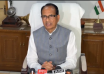
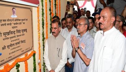
Govt. to formulate policy to provide relief in encroachment cases involving poor and landless families: CM
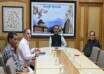
Chief Minister Thakur Sukhvinder Singh Sukhu today laid the foundation stone of the new Mu…
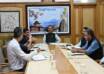
Govt. to formulate policy to provide relief in encroachment cases involving poor and landless families: CM
Chief Minister Thakur Sukhvinder Singh Sukhu today laid the foundation stone of the new …